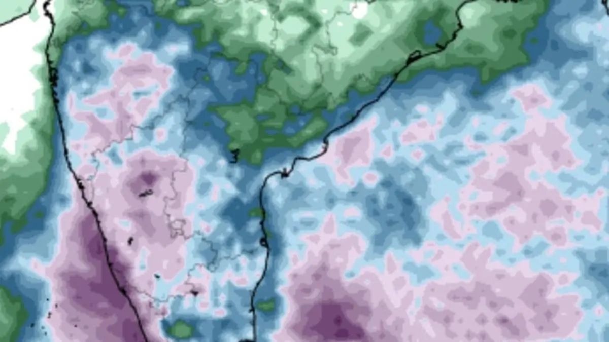
European Centre for Medium-Term Weather Forecasts persists with outlook for heavy to very heavy rain (in purple colour) over coastal Kerala and Karnataka for next three days with onset of south-west monsoon not too far away.
| Photo Credit:
www.tropicaltidbits.com
The India Meteorological Department (IMD) has confirmed that a cyclonic circulation may form over the east-central Arabian Sea off the Karnataka coast around Wednesday and evolve into a ‘monsoon vortex’ in the form of a low-pressure area the following day.
Thereafter, it is likely to move northwards and intensify further — a development first reported by businessline four days ago, based on the IMD’s own short- to medium-range forecasts.
Monsoon in Sri Lanka
This may set up a spectacular onset of the monsoon, which appeared to have reached Sri Lanka — the penultimate station — on Friday or Saturday, according to the IMD’s plotting of monsoon advance across the seas. Onsets have already been declared over Myanmar, the Andaman and Nicobar Islands, and the Maldives along the way. Kerala typically receives the monsoon about a week after Sri Lanka.
Fairly widespread to widespread rainfall, thunderstorms, lightning, and gusty winds (30-50 km/hr) — which more than satisfy the conditions for onset — have been forecast over Kerala and Mahe, Lakshadweep, and Coastal Karnataka for the next seven days. This stretch of the southwest coast is traditionally where the monsoon first sets in.
Heavy rain forecast
Isolated heavy rainfall is likely over Coastal Karnataka, Kerala, and Mahe for the next six days; over Lakshadweep and Telangana for two days; over Interior Karnataka, Tamil Nadu, Puducherry, and Karaikal for the next 3-4 days; and over Rayalaseema on Monday.
Isolated very heavy rainfall may lash Kerala and Mahe, and Coastal Karnataka on Tuesday; North Interior Karnataka on Monday and Tuesday; and South Interior Karnataka on Sunday (today) and Monday, the IMD said in its outlook for the next week.
Onset may unfold
Global forecast models indicate that the onset may occur during this phase, which falls within the timeline set by the IMD. Scattered to fairly widespread rainfall, thunderstorms, lightning, and gusty winds are also likely over Tamil Nadu, Puducherry and Karaikal; Coastal Andhra Pradesh and Yanam; Rayalaseema; Telangana; and Interior Karnataka, as the Bay of Bengal contributes to the system. A helpful circulation persisted over the southeast Bay on Saturday, with a trough extending from it towards central Coastal Andhra Pradesh.
On Saturday, the IMD said the monsoon had advanced into more parts of the south Arabian Sea, Maldives, and the Comorin area. Also covered during this phase were the South Bay, the remaining Andaman Islands and Andaman Sea, and parts of the east-central Bay.
Pre-monsoon sizzles
Meanwhile, heavy pre-monsoon weather was reported over land during Friday and Saturday, with heavy to very heavy rainfall recorded in Assam and Meghalaya, and Madhya Maharashtra, while heavy rainfall was also reported in Arunachal Pradesh; Nagaland; Manipur; Mizoram; Tripura; the Andaman and Nicobar Islands; the hills of West Bengal and Sikkim; Odisha; and Tamil Nadu, Puducherry, and Karaikal. Hailstorms lashed Himachal Pradesh, while a dust storm swept through East Uttar Pradesh.
Published on May 18, 2025
